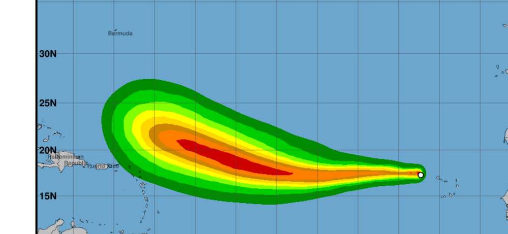
Erin could be the season's first hurricane
Just as the Wakefield division of the National Weather Service was starting its Monday morning briefing, the National Hurricane Center announced that Tropical Storm Erin had formed.
The cyclone is just west of the Cabo Verde Islands off the coast of Africa and is starting to show a good rotation.
Forecasters are warning interested parties not to get caught in the myriad of computer models, as the storm is so far away and that steering currents have yet to come into play.
Most, however, agree that the storm likely will stay on its current west to northwest track at 15-20 mph until it gets close to Puerto Rico.
From there, it’s anybody’s guess.
NHC forecasters are calling for the cyclone to become a hurricane - possibly a major storm of Category 3 or worse - by the end of the week.
While there still is a lot of watching to do, the majority of the most trusted models currently have the system taking a turn to the north - staying off the U.S. coast and possibly threatening Bermuda.
The NHC is pleading with people to not get over-anxious, but reminds them that it’s a good time to go over the family plan, and get all important and essential goods in order.
Hopefully, none of that will be necessary this time around. But it could serve as a solid practice run.
We’ve arrived in the upswing of activity in the 2025 Atlantic Hurricane Center and things are going to start getting busy.
So stay tuned - it’s a good bet that more is to come.