Another week of crazy weather
It’s not going to be the kind of one hopes for.
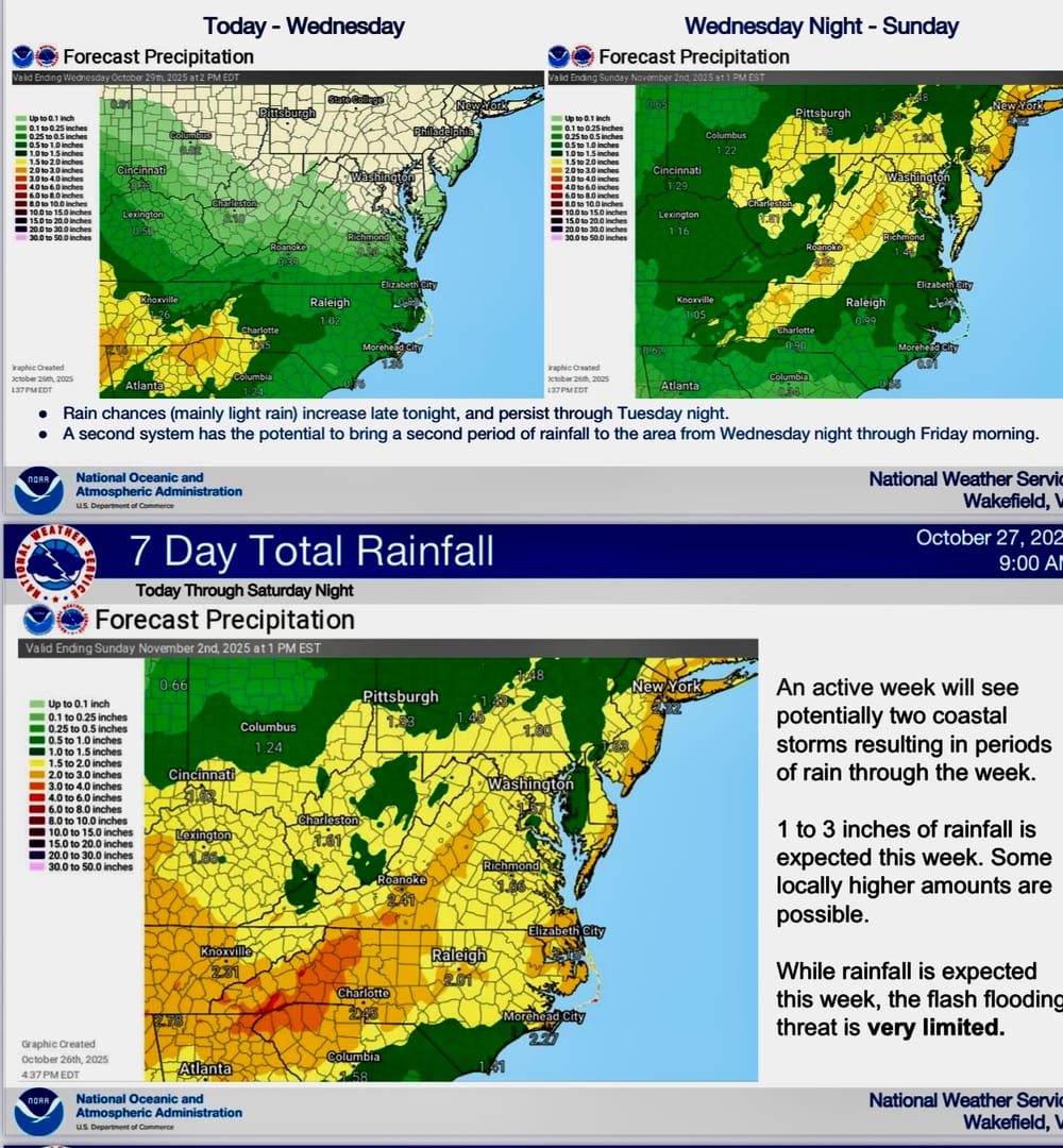
During its Monday webinar, the Wakefield office of the National Weather Service talked about a pair of low pressure systems expected to form and ride along a cold front sinking in from the northwest.
One starts tonight and the other during the end of the week - both bringing high winds and a healthy amount of rain.
The area could use a good dosing of water since the vast majority of the region has been under drought conditions.
Winds are another product these systems will add to the mix and will likely push extra water into the Chesapeake Bay and its tributaries. While tides will be high in most inlets, fishing in those places could be just about the only boating going on until a forecast weekend with much nicer conditions.
Lynnhaven Inlet and its many marinas and home-owner docks could see some of the worst of potential tidal flowing. Boats who spend down time moored to docks will need to see some storm preparation for the week.
Gale and storm force winds that will keep most vessels away from the ocean could cause more beach erosion. That’s especially bad news for southern portions of Hatteras Island - especially to abandoned homes along the sand in Buxton, where more could fall into the sea.
The entire week could produce up to 3 inches of total rain.
Future blows from currently Category 5 hurricane Marissa could cause more erosion as the system rides along just to our east after making landfall in Jamaica and Cuba in the next couple of days.